Student handout
What Water Leaves Behind
What can running water tell us about the land it moves through, and how should we share what is left?
Print this handout
The photographs
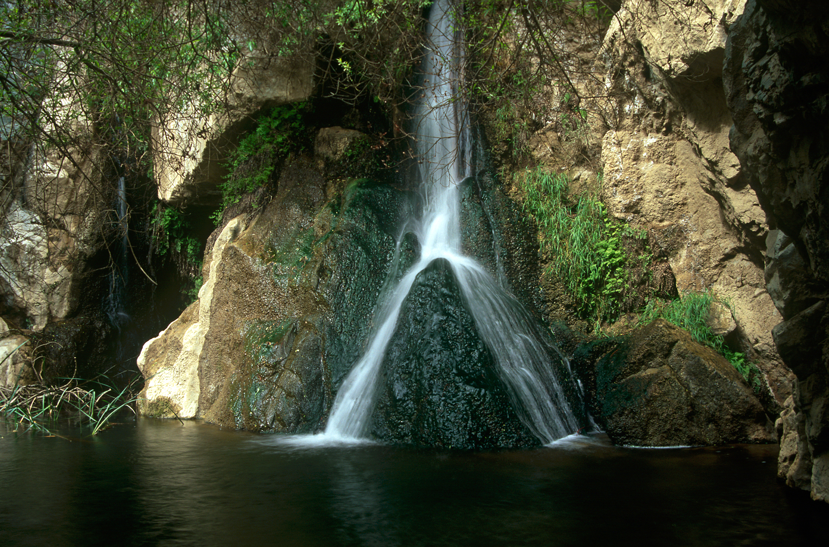
Photograph 1 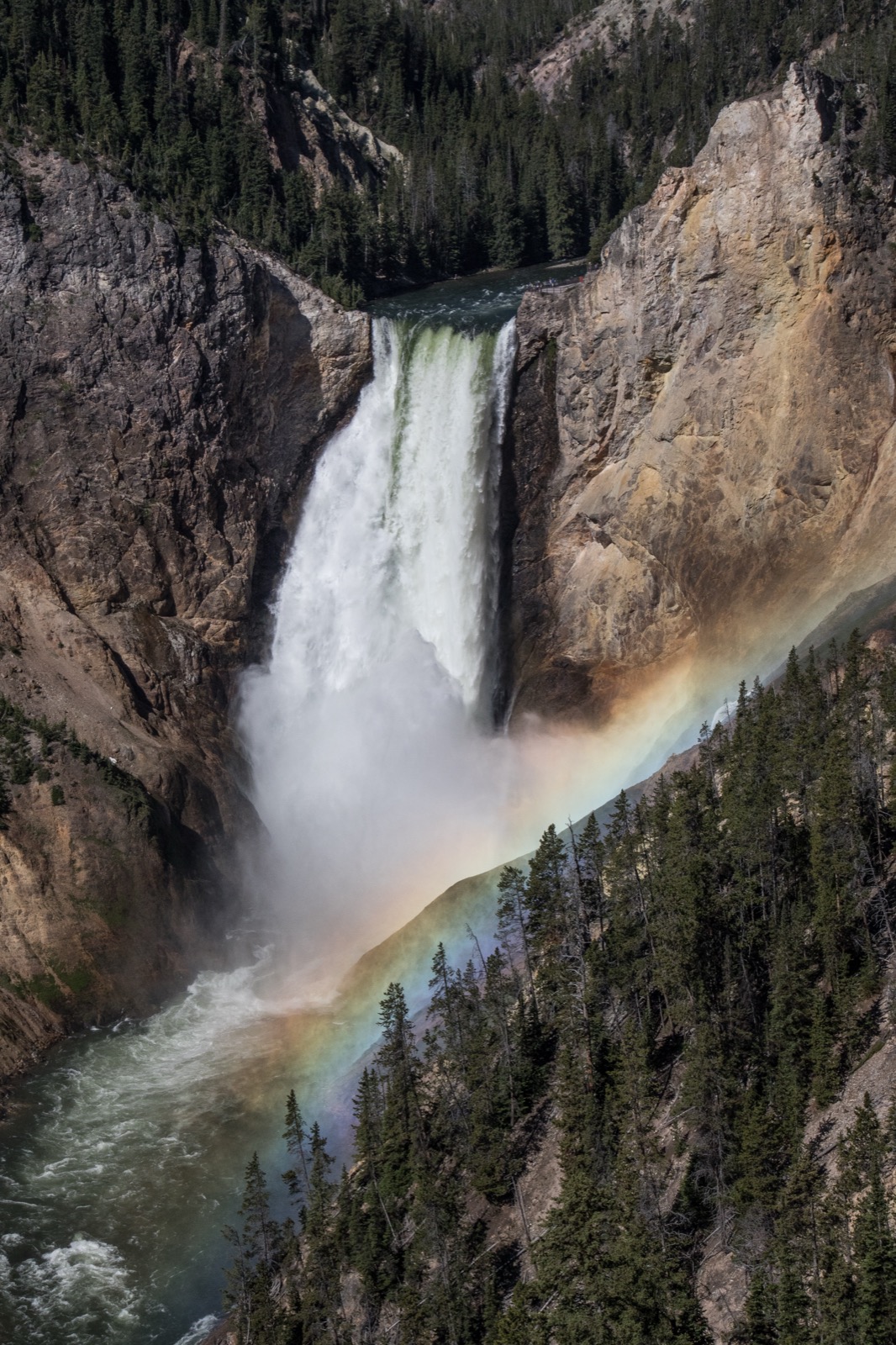
Photograph 2 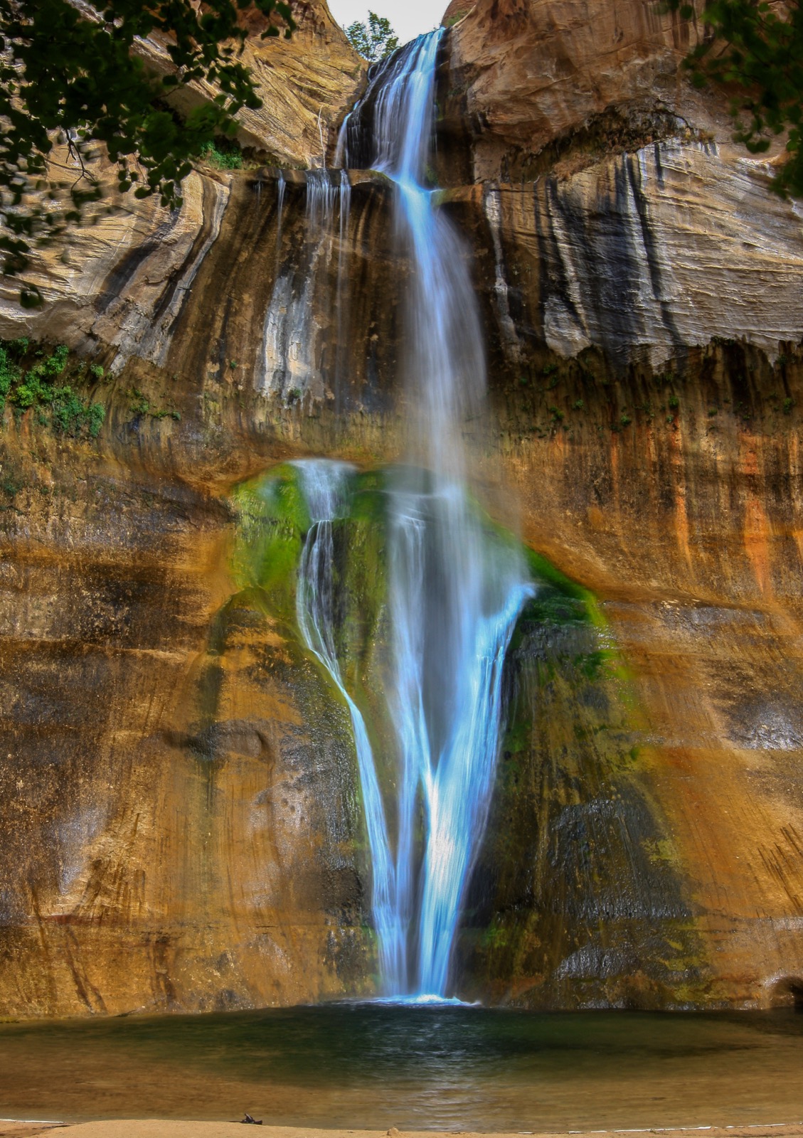
Photograph 3 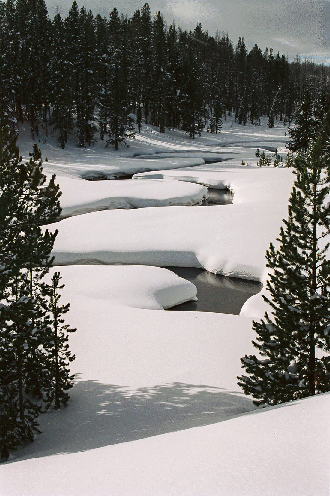
Photograph 4 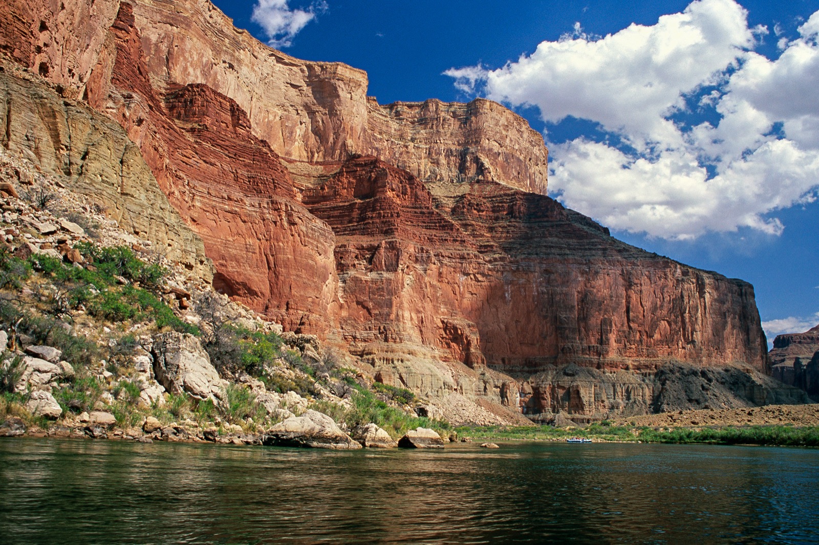
Photograph 5
01. Setting the stage
You are looking at a place in the United States. Where do you think this is — and how much rain do you think it gets in a year?
02. Engaging with the story
Keep a running list of every place in these images where water clearly goes, and every place it clearly does not. Not what you think is happening. Just where the water is and is not.
03. Working the evidence
Observe (5 minutes). Record only what is visible. No explanations yet.
- What do you notice first?
- What materials, textures and colors can you see?
- Where exactly is the green, and where exactly is it not?
- Look again for a full silent minute. What did you miss?
Reflect (6 minutes). Now generate and test explanations.
- What do you think is happening here?
- Look at the rock the water is not touching. What does it tell you about how much rain this place gets?
- If it does not rain much here, where is this water coming from?
- Compare photograph 1 with photograph 3. Both show water falling onto rock with a pool at the bottom. What is the pool doing?
- What is missing from these images?
Question (4 minutes).
- What do you wonder about: who, what, when, where, why, how?
- Standing there with any instrument you wanted, what would you measure first?
04. Delving deeper
Read all three tables before you answer anything.
| Where | Share of all Earth’s water | Share of fresh water |
|---|---|---|
| Oceans | About 96.5 percent | — |
| Ice caps and glaciers | 1.74 percent | 68.7 percent |
| Groundwater | 1.69 percent | 30 percent |
| All rivers | About 1/10,000th of one percent | — |
Source: U.S. Geological Survey, Water Science School.
| Measure | Value |
|---|---|
| Share of water supply from snowmelt, in some western states | As much as 75 percent |
| What a snowpack does | Stores cool-season precipitation and releases it in the warm season — a reservoir nobody had to build |
| Effect of heavier dust settling on that snow | Peak runoff at Lees Ferry, Arizona arrives on average 3 weeks earlier |
| Effect on the year’s total runoff | Reduced by more than 1.0 billion cubic meters, about 5 percent of the annual average |
| When the dust increase began | A fivefold increase from disturbed soils was already under way by the late 1800s |
Sources: U.S. Geological Survey; Painter et al., PNAS, 2010.
| Measure | Value |
|---|---|
| Length | About 1,400 miles |
| Basin area | About 250,000 square miles |
| States it serves | Arizona, California, Colorado, Nevada, New Mexico, Utah, Wyoming |
| People relying on it | Between 35 and 40 million, for some or all of their municipal water |
| Share used by agriculture | 70 percent |
| System storage today | About 36 percent of capacity, after long-term drought |
Source: U.S. Bureau of Reclamation, Colorado River Basin.
05. Reflecting and projecting
Part A. Read the evidence. Based on the photographs alone, what can you conclude about the water in these places? And just as important, what can you not conclude?
Part B. Make the call. A water district that draws from a snow-fed river has applied to increase its annual withdrawal by 10 percent. The river’s flow changes from year to year with the snowpack, and the water already promised to existing users adds up to more than the river has carried in recent years. Should the state approve the increase?
- Your claim. State your position in one or two sentences.
- Your evidence. At least two specific observations from the photographs, plus one item from Tables 1, 2 or 3. Name the source of each.
- Your reasoning. Explain the scientific and practical principles that connect your evidence to your claim.
Students may submit as a written paragraph, a recorded verbal explanation, an annotated photograph, or a labeled diagram. All four are acceptable and the rubric applies equally.
06. Take action
Choose one.
- Your own water. Where does the water from your tap come from? Name the source, the watershed, and how far it travels. If it is groundwater, find out how long ago it fell as rain.
- The snow line. Find the snowpack record for the mountain range nearest you, or the nearest one that has one. What has it done over the last thirty years, and who depends on it?
- Dust and snow. Read about dust deposited on mountain snow. Where does the dust come from, what does it do to melt timing, and does it change your answer to question 6?
07. The rebuttal
Your rebuttal. Someone reaches the opposite conclusion from the same evidence. State their position as fairly as you can, then explain why the evidence favours yours. If you think the evidence does not settle it, say so and explain what would.
Discussion questions
- In photograph 1, look at the rock the water is not touching. What does its color and its plant cover tell you about how much rain this place gets?
- Photographs 1 and 3 both show water falling onto rock with a pool at the bottom. What is the pool doing to the rock?
- In photograph 2 a rainbow stands in the air below the falls. What has to be in the air for that to happen, and what does it tell you?
- Photograph 4 shows almost no moving water. Is that stream doing less work than the others, or the same work at a different time?
- In photograph 5 the raft is a few meters long and the cliff is hundreds of meters high. Which of those two did the river make?
- Open question. A river’s flow comes mostly from mountain snow, and the amount of snow varies from year to year. The water has already been promised to cities and farms. Who should go short in a dry year, and how would you decide?